 2 personnes d’Andromède se rendront à Portoroz en Slovénie du 27 au 31 octobre prochain pour participer au symposium sur les habitat-clefs de Méditerranée.
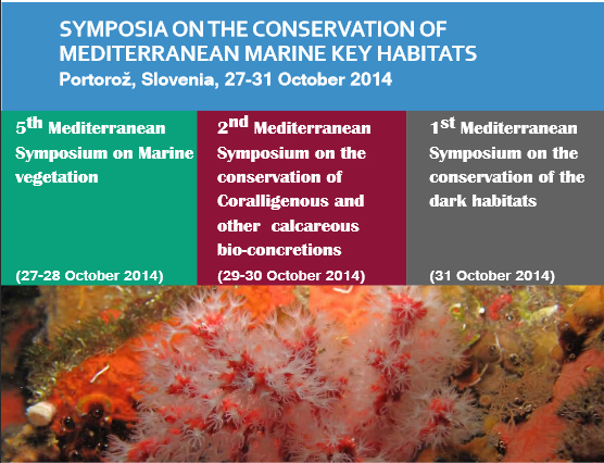
Ce symposium en regroupe en fait 3:
– 5th Mediterranean Symposium on Marine vegetation (27-28 October 2014)
– 2nd Mediterranean Symposium on the conservation of Coralligenous and other calcareous bio-concretions (29-30 October 2014)
– 1st Mediterranean Symposium on the conservation of the dark habitats (31 October 2014)
Les résumés des 4 communications orales acceptées sont ci-dessous:
1.Environmental factors explaining taxonomic heterogeneity of coralligenous outcrops across France (northwestern Mediterranean) by Holon Florian, Boissery Pierre and Deter Julie
Determining which environmental variables shape the assemblages observed at different sites remains a central question in ecology. Mediterranean coralligenous assemblages although comparable to tropical reef assemblages in terms of richness, biomass and production, are less known and studied, especially because of their presence in deep waters. Our goal is to investigate at a large scale the patterns of taxonomic diversity in relation to environmental and spatial factors. We used 120 stations sampled for sessile macro-organisms (vegetal and animal) with photographic quadrats all along the French Mediterranean coast (RECOR program). The influence of five physical environmental variables (longitude, latitude, surface temperature, turbidity, depth, sedimentation, crevice, debris) and three spatial variables (latitude, longitude, depth) was tested on the structure of taxa assemblages (relative abundance).
In total, 173 taxa were identified. The species assemblages were explained at 28.75 % by the complete model: spatial factors explained 19.02 % of the variance while environmental factors explained 9.73 % of the remaining variance. The best model (R²=0.27) included the following factors: latitude, depth, water temperature, water turbidity, sludge percent cover and debris. The number of taxa was best explained by water turbidity while the shannon index was best explained by the crevice percent cover.
2. First continuous seabed map in France. Use for the creation of a management tool protecting Posidonia oceanica by Holon F., Delaruelle G., Guilbert A., Deter J., Boissery P., Descamp P.
Mediterranean sea is a biodiversity hotspot facing numerous threats: the highest population density, high urbanization, coastal erosion, overexploitation of marine resources and spread of invasive species. Maps of marine habitats are an essential tool in order to appreciate ecological and spatio-temporal heterogeneity of the environments, potential and real distribution of species, identify corridors but also propose relevant management measures and evaluate their effects. Different works allowed the realization of high scale marine habitat maps. It resulted in a patchwork of more or less connected maps. Through the program DONIA, we reviewed and complete 30 years of work in order to obtain a continuous map of the 1700 km of French coast and 47 water bodies.
We obtained a 1:5000 continuous map for seabed habitats using ten classes. The results are freely available (with login) on www.medtrix.fr in DONIA®expert. Besides the complete French Mediterranean coast (L-R, PACA, Corsica), several Mediterranean islands are concerned: Galite archipelago in Tunisia, Zembra island in Tunisia and Tavolara – Punta Coda Cavallo in Sardinia (Italy). A simplified database called DONIA® intended for general public is also freely available on Medtrix without any login. The same regions are concerned but habitats were simplified into 4 classes (seagrass, dead matte, sand, rock) instead of ten. This simple dynamic map is freely accessible to all though DONIA® application (App Store and Google play), helping boat to anchor safely outside of sensitive habitats. The application opens new perspectives in terms of management of marine protected areas by facilitating the communication between site managers and visitors and providing an active management of mooring.
3.Medtrix: a cartographic database for marine ecology and anthropogenic pressures along the Mediterranean coast by Holon Florian, Delaruelle Gwenaelle, Boissery Pierreand Deter Julie
Biodiversity hotspot, commercial exchanges area and major touristic destination in the world, the Mediterranean sea concentrates important and paradoxical stakes. In this context, it is even more essential to analyze species and habitat distribution, environmental variables and human threats but also their correlates, and likely consequences. The spatial distribution of anthropogenic pressures is particularly interesting because this is the basis of numerous other studies: ecological indicators development, species distribution analysis, reserve design, conservation plan…But the data that we need in order to provide spatial resolution relevant for management considerations are still lacking or not easy to reach. Here we describe Medtrix (http://www.medtrix.fr), a cartographic platform that regroups different databases made available for marine professionals (scientists, managers, stakeholders). This meta-database is the first one available at such a good resolution (20 m for the anthropogenic pressures) all along the French Mediterranean coast and along some other countries (Tunisia, Italia). These cartographic data concern for the moment anthropogenic pressures (harbors, wastewater, population density, aquaculture), 1:5000 seabed habitat maps, marine mammals observations but also monitoring of the two most important ecosystems in Mediterranean sea: Posidonia oceanica seagrass (presence/absence, vitality) and coralligenous habitat (presence/absence and diversity data). The platform proposes different functionalities like editing maps but also to directly comparing sites. One of the databases is already the basis of a management tool: DONIA® application which helps yachtsmen to anchor in a safe (environment and security) way.
4.Predicting Posidonia oceanica beds regressions using anthropogenic pressures maps along a French coastal region by Holon Florian, Bockel Thomas, Boissery Pierre and Deter Julie
During the last half century, the development of coastal anthropogenic activities is at the origin of increasing pressures on marine coastal ecosystems. The management of those multiple and simultaneous threats moreover requires reliable and precise data on the distribution of the pressures and of the most sensitive ecosystems. Posidonia oceanica beds (Tracheophyta) are encountered between the surface and a depth of 30-40 meters. Despite their important ecological and economical roles, they are threatened by many human activities. Regressions can be mapped on the basis of the visible areas of dead mattes and historical data. We used Random Forest algorithm to make predictions of P. oceanica beds regression data according to anthropogenic pressures along a Mediterranean French region (Provence-Alpes-Côte-d’Azur). Pressures tested appealed to reclamations from the sea, coastal population, aquaculture, wastewater effluents, anchoring areas weighted, coastal land cover, and stream effluents data as a function of bathymetry and currents. Model performances were particularly good for extreme ecological states (classification error rates of 5% and 27% respectively for regression rate < 10 % and > 90 %). The siltation was the major parameter forcing the distribution of P. oceanica mattes, while sketches of ecological thresholds regarding aquaculture, anchoring and coastal infrastructures are proposed.