CARTOGRAPHY
Biocenosis cartography is the basic tool necessary for the analysis of the initial state of a site, whether one is in the process of coastal development or the management of a marine protected area.
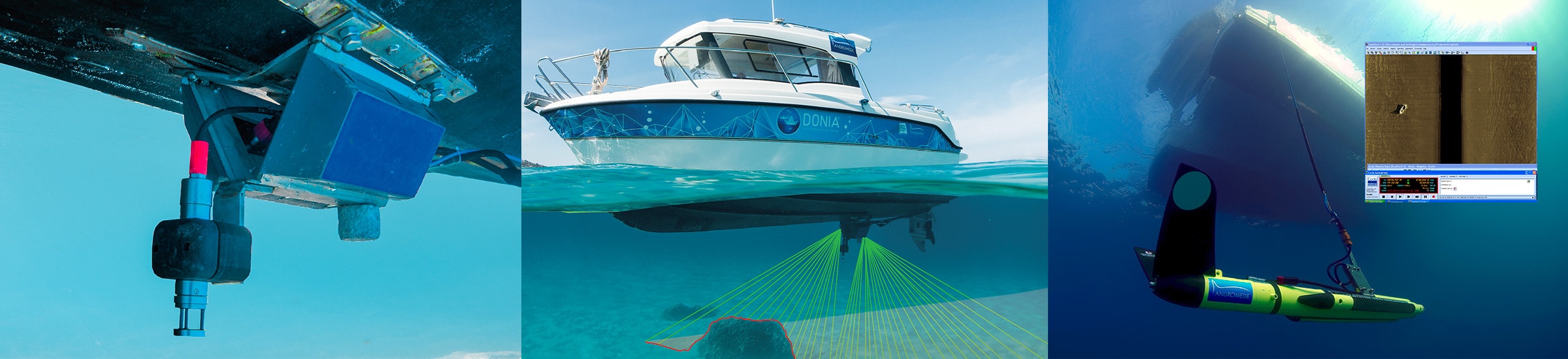
The cartographic work requires the acquisition of a large number of data which it is then archived, processed and restored. Each mission implies lateral sonar surveys, single or multibeam bathymetries, aerial or satellite photographs, direct observations by diving or by on-board camera, direct debits, etc.
Andromède Océanologie has all the tools and knowledge required to build a structured geographic data system that can be included in a wider project or published on a web platform such MEDTRIX
Typically the mapping of biocenoses is carried out at 1 / 5,000th or 1 / 10,000th. We have therefore developed new methods in this sector such as acoustic telemetry micro-mapping (for accuracy up to 1 / 50th) or photogrammetry (for 3D views).